Ultimate Hiking Guide to Tierra del Fuego, Argentina: Explore Ushuaia’s Best Trails
In December 2024, I stayed in Tierra del Fuego Province for 11 days. During this time, apart from the capital Ushuaia, I also extensively visited two other cities, Rio Grande and Tolhuin. Out of personal interest, I mainly traveled on foot and hardly participated in any commercial activities. Overall, I felt that the exploration by Chinese people of Tierra del Fuego (especially Ushuaia) is far less than its worth, especially for hiking enthusiasts, who should definitely set aside some time!
[StrawberryR] Transportation
Uber can be used throughout. There is also public transportation within the city, which can be considered for short distances if you have enough time. A single trip costs 800 pesos, using a SUBE card. You can download “Mi Bondi” to check routes and schedules, with buses running approximately every 15 minutes. p2

[PeachR] Hiking
I mainly walked three hiking trails, and overall, I recommend Estancia Túnel > National Park > Emerald Lake.
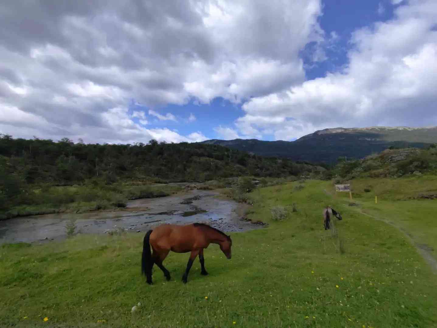
[OneR] Tierra del Fuego National Park
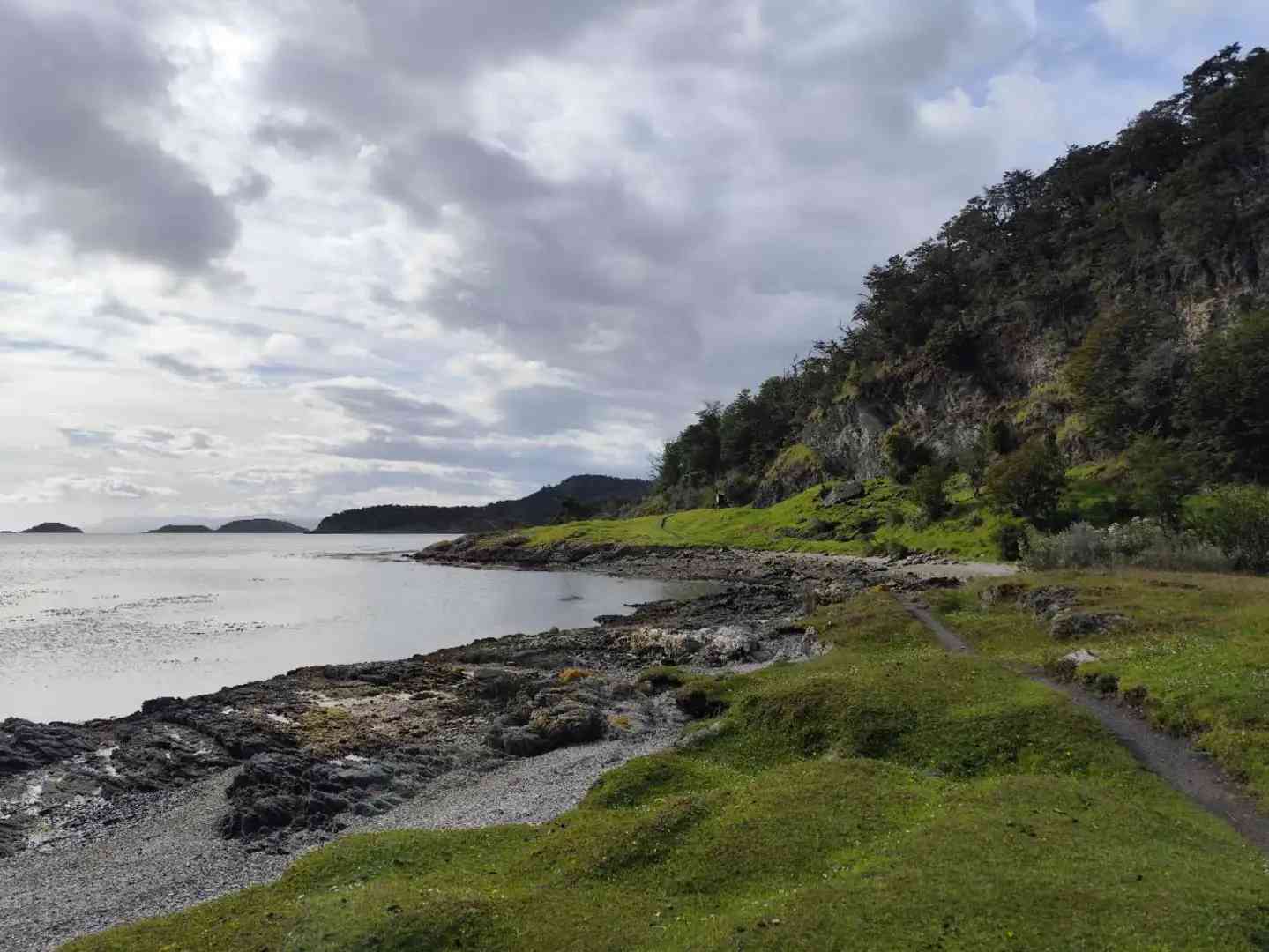
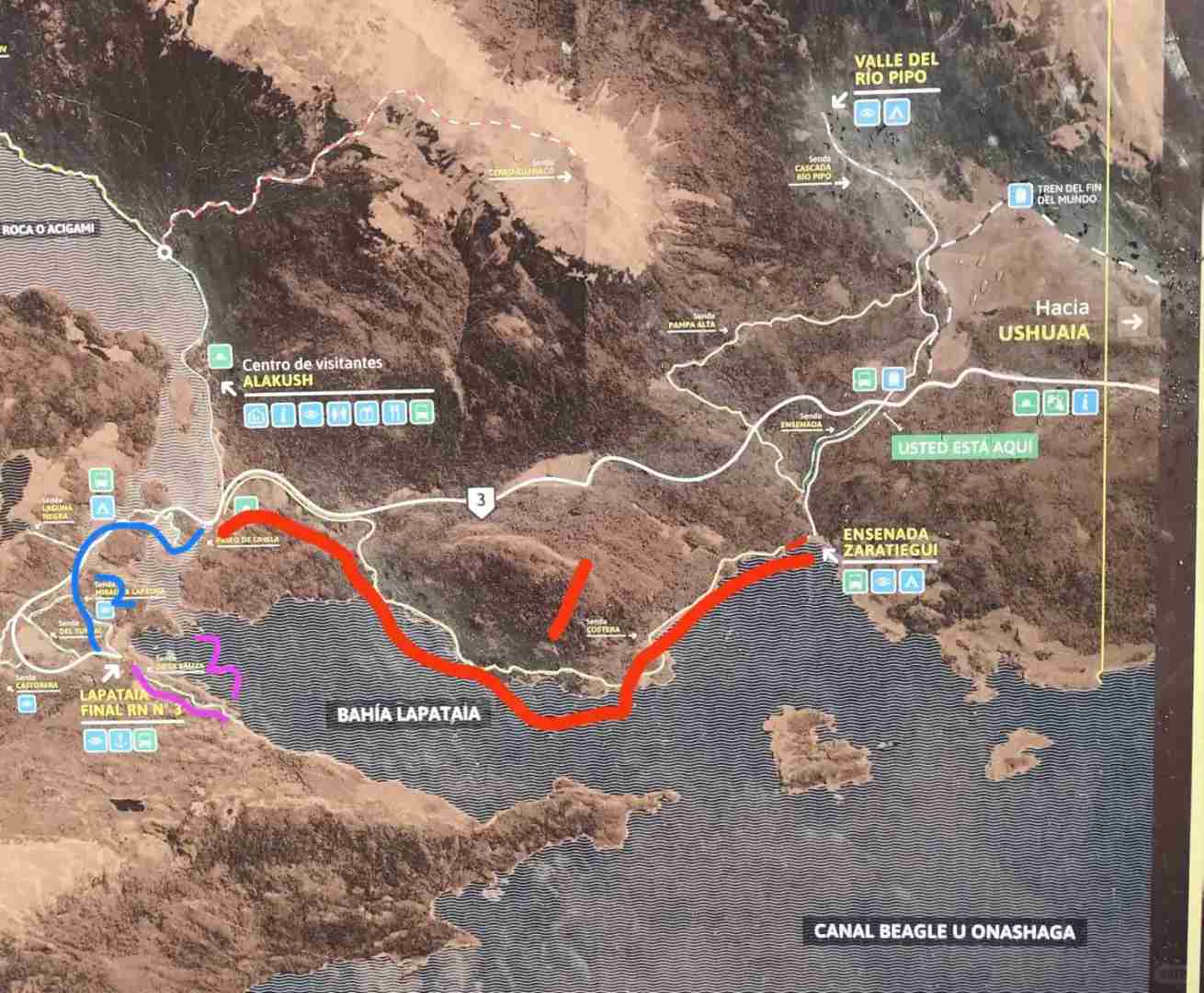
The park is very large, with over ten trails. However, according to the official map, there are only three main routes (p3). The first route is a coastal path of about 7 km, the second is an island path of about 3 km, and the third is a lighthouse path of about 2 km. The signage is clear throughout. Based on my personal experience, the scenic ranking of the three sections is 1 > 3 > 2. You can choose to skip some based on this ranking (see p4-6).
[Purple HeartR] If you are physically fit and plan to hike the entire trail, you can enter the national park before 7 AM. Take an Uber directly from the city to the post office (about 10,000 pesos one way), then start the three routes along the coastal path. When returning, you can take an Uber from the ticket office or hitchhike back on the main road.
Note: The total round-trip distance is about 35 km, and the best scenery is only on the three mentioned routes, with no public transportation available. Therefore, you must assess your physical condition before choosing this option.
[Blue HeartR] This might be a more suitable option for many. On the day, go to the central station in the morning to buy tickets. Buses leave roughly every hour from 9 to 14, and return at 15, 17, and 19. The round-trip fare is 20,000 pesos (as of Dec 24). Upon arrival at the entrance, you will be organized to get off and buy tickets (40,000 pesos).
The bus stops at the starting and ending points of the three routes. Choose your route based on your physical condition and time. It is recommended to get off at the End of the World Post Office and start the first route, then return from the end of the first route.
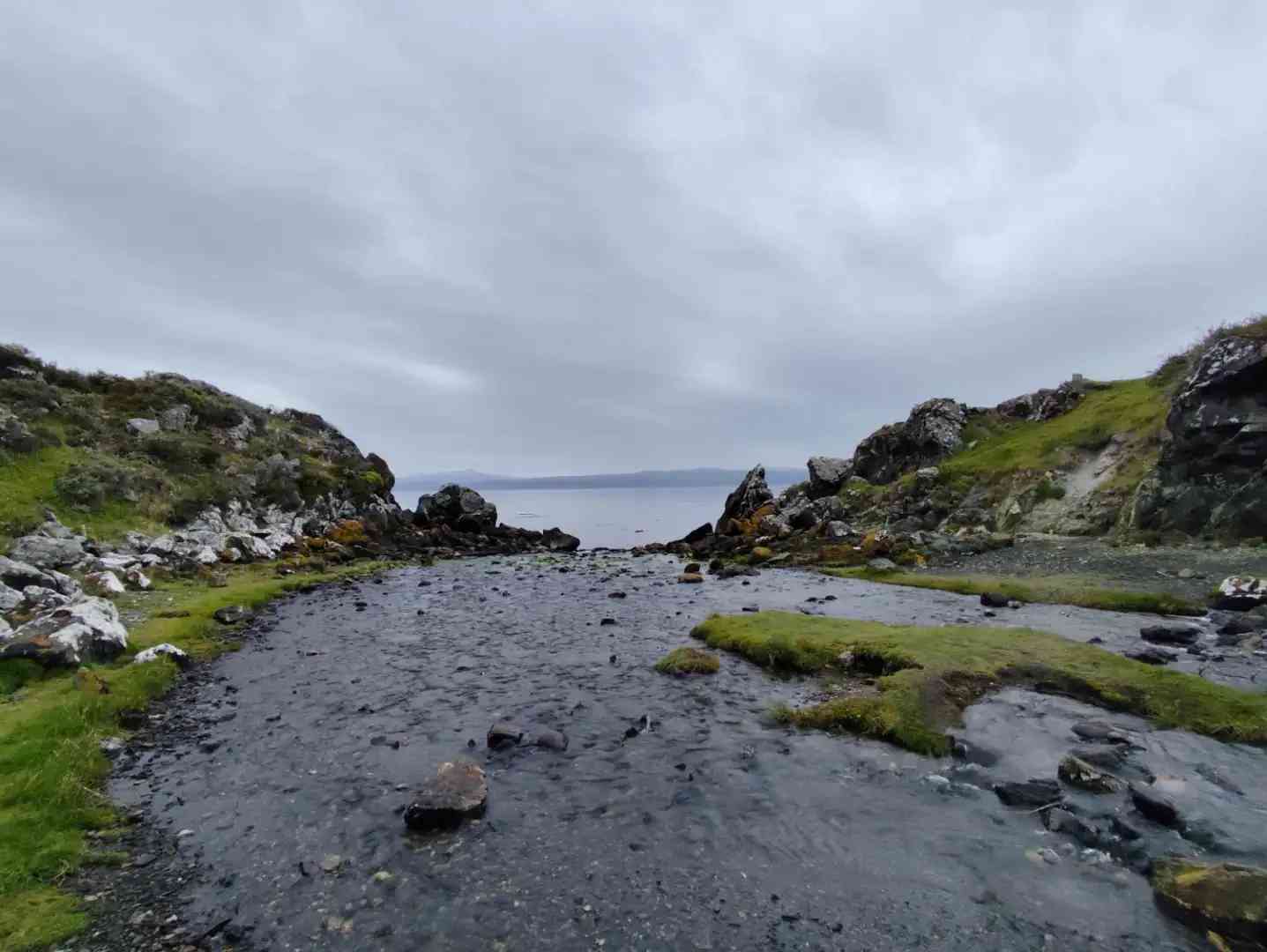
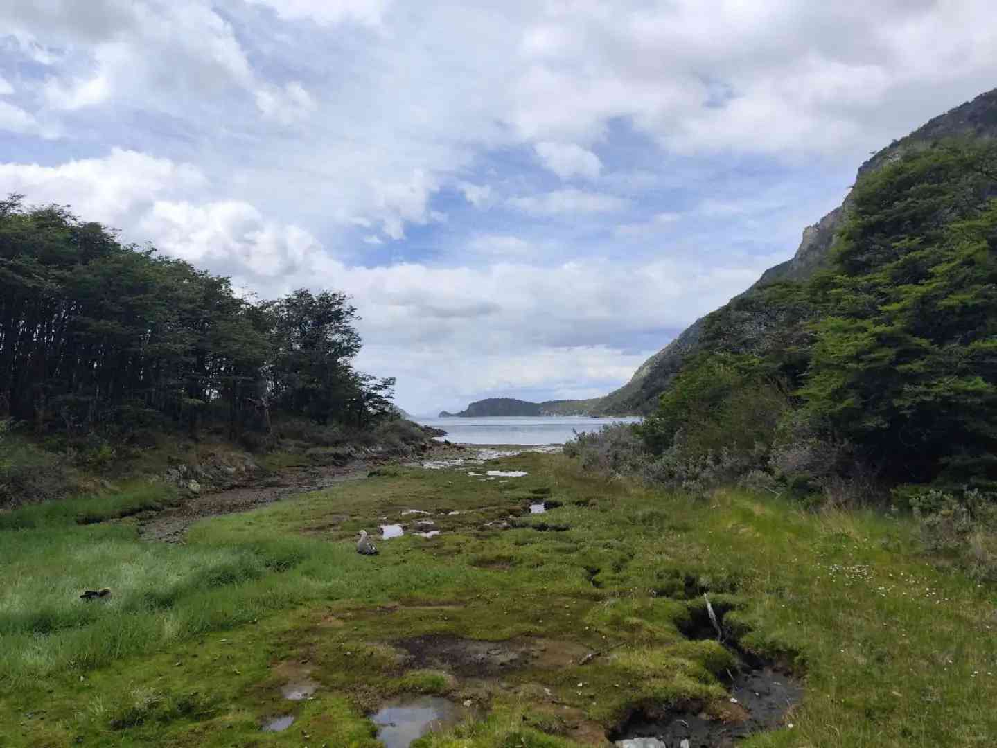
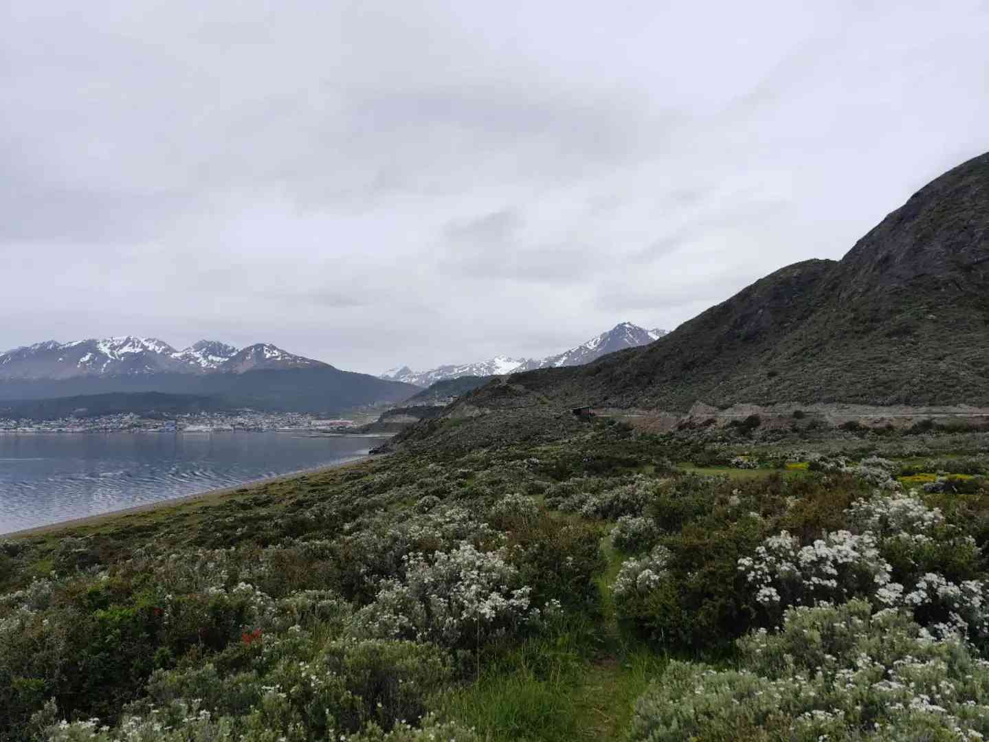
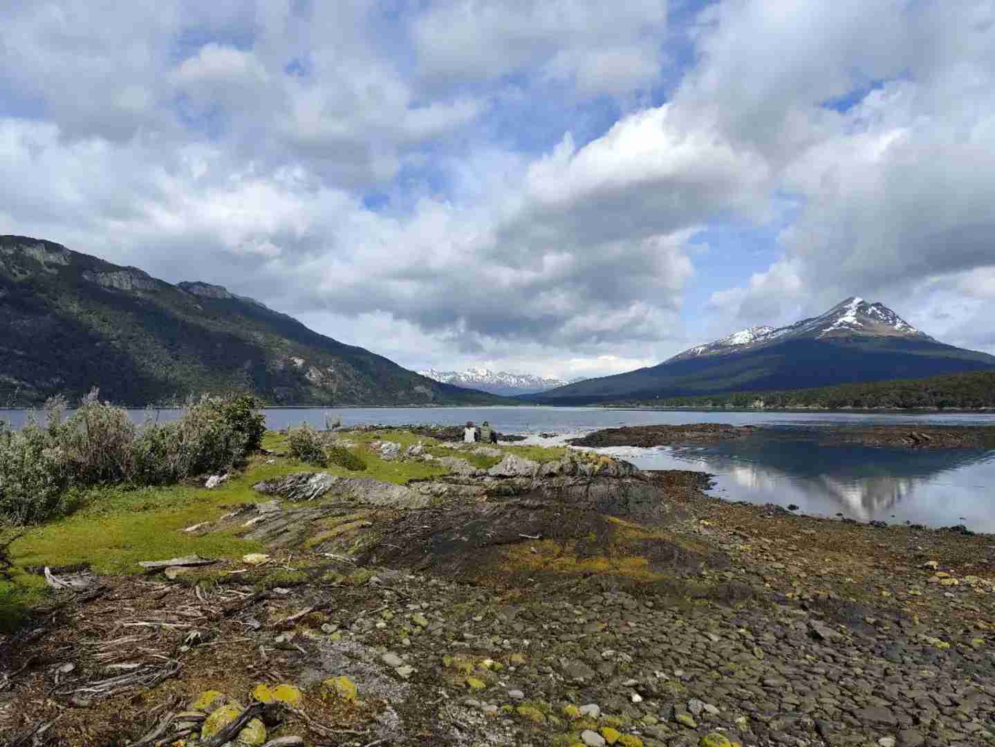
[TwoR] Playa Larga + Estancia Túnel (p7-9)
This is the top recommendation for hiking in Ushuaia, offering breathtakingly beautiful scenery. Here, you can soak in panoramic views of the Beagle Channel. Best of all, there’s no entrance fee, and the vistas are even more spectacular than those in the national park.
You can easily reach Camino Playa Larga by bus or taxi from the city, and then begin your adventure. The total round trip is about 10 km, and the trail is smooth and easy, with a difficulty level of 0, making it perfect for hikers of all skill levels.
[ThreeR] Emerald Lake (p10-13)
Emerald Lake is a gem, though it may seem slightly less impressive compared to other sites. Catch the 10 AM bus from the central station, with a round-trip fare of 15,000 pesos, and plan to return at 3 PM. Upon arrival, follow the group, and you’ll find the path to be well-maintained, albeit a bit muddy.
The hike takes about an hour one way, as the name suggests. Walking around the lake, you’ll feel a sense of wilderness and tranquility, making it a peaceful escape into nature.
Small tips are in the comments! [Cherry BlossomR] Feel free to ask if you have any questions!

