Discover Scenic Hikes in Tongariro National Park, New Zealand’s Natural Wonder
📍Address:
– Starting Point: Mangatepopo Car Park
– End Point: Ketetahi Car Park
Difficulty Level: 🌟🌟🌟
Recommendation Level: 🌟🌟🌟🌟🌟
Introduction: Nestled in the heart of New Zealand, Tongariro National Park stands as the country’s first national park and is home to the renowned Tongariro Alpine Crossing, often hailed as one of the world’s best one-day hikes. This point-to-point trek offers a breathtaking array of landscapes, from steaming vents and ancient lava flows to serene crater lakes.
Route:
The official Department of Conservation (DOC) designation for the trail is 19.4 kilometers, but many hikers report distances exceeding 22 kilometers when tracked with sports apps. The recommended starting point is at the end of Mangatepopo Road, with the journey concluding at Ketetahi Road End.
Both locations provide ample parking. During the peak season (November to April), parking is restricted to 4 hours, making it essential to pre-arrange shuttle services. For solo travelers, the most flexible and budget-friendly option is to park near the end point on Highway 46 and take a shuttle to the trailhead.
Scenic Spots Along the Way:
1. **Soda Springs (4.5km)**: A short 20-minute detour off the main path, Soda Springs offers a close-up view of crystal-clear streams cascading down lush, cliffside vegetation, fed by melting snow from the surrounding peaks.
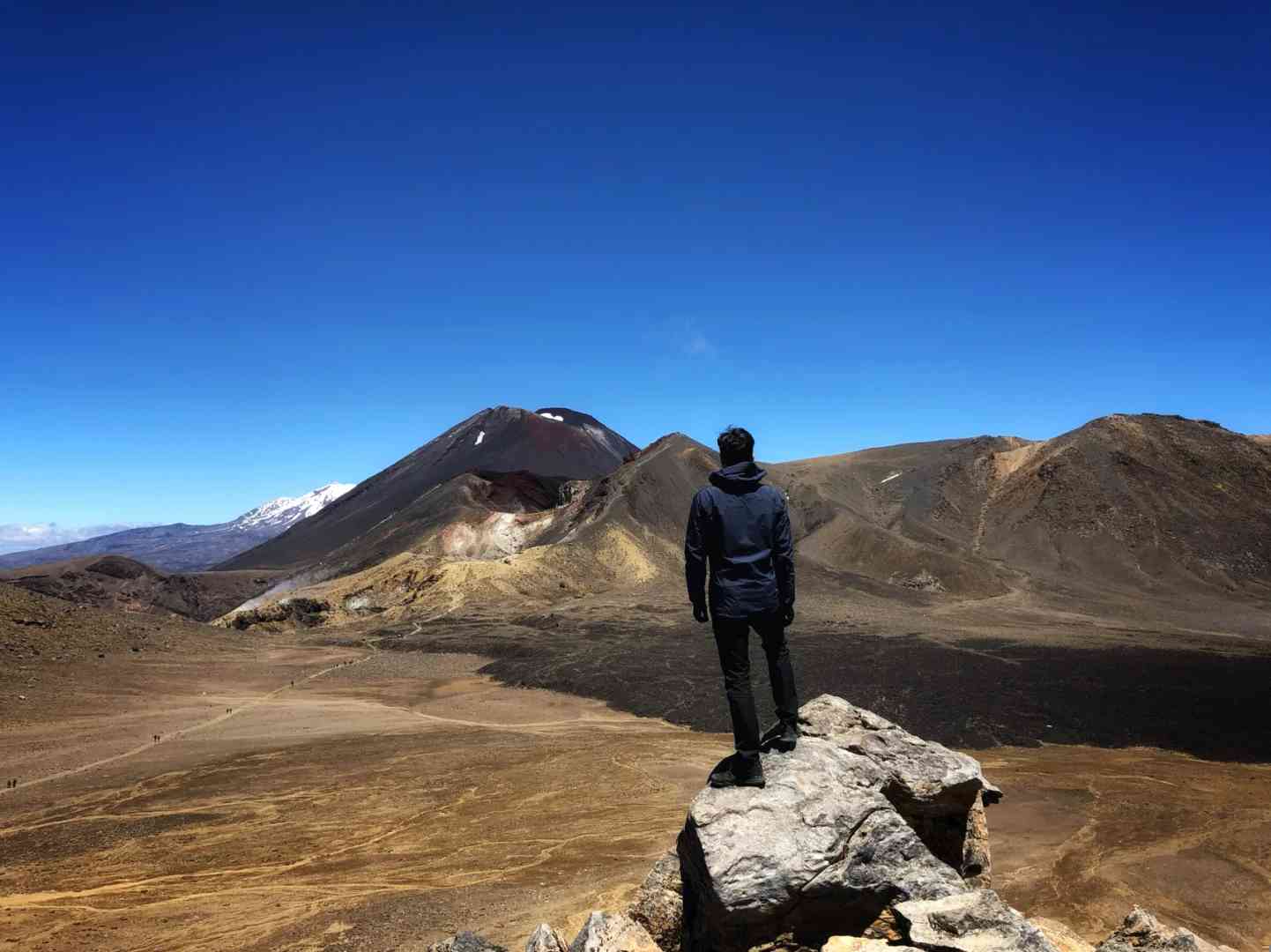
2. **Saddle (7 – 8km)**: This saddle valley between Mount Tongariro and Mount Ngauruhoe presents a stunning vista.
The vast, mirror-like plain stretches out before you, with the flat-topped Mount Tongariro to the north and the iconic cone-shaped Mount Ngauruhoe to the south.
3. **Red Crater (8.5km)**: The highlight of the route, this section is also the most challenging. At an elevation of 1868 meters, Red Crater is the highest point of the trek.
Here, you can marvel at the massive volcanic pit and the striking rust-red ash deposits, a vivid reminder of the area’s volcanic past.
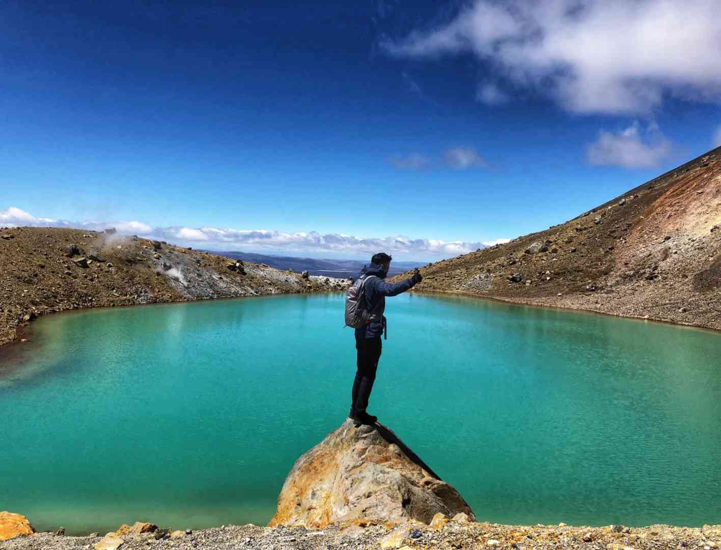
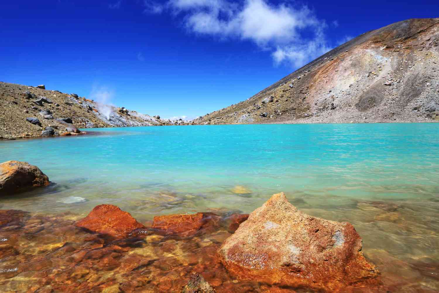
4. **Emerald Lakes (9km)**: Descending from Red Crater, you’ll encounter three emerald-green crater lakes of varying sizes, nestled at the foot of the mountain. The vibrant green waters are surrounded by sulfur-colored soil, with wisps of steam rising from the ground.
5. **Blue Lake (10.5km)**: From the Emerald Lakes, a gentle descent leads to Blue Lake, the largest volcanic lake on the route. The deep, indigo-blue waters create a mesmerizing contrast against the rugged landscape.
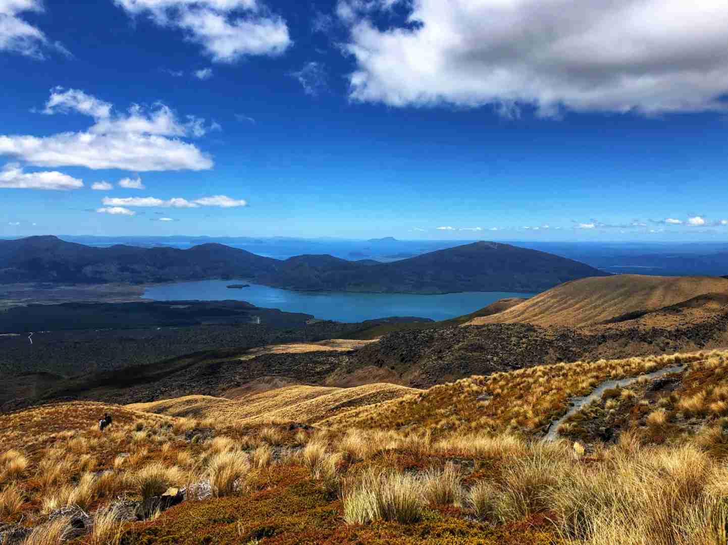
6. **North Slope of Tongariro (11-20km)**: Continuing from Blue Lake, a long downhill section awaits, offering panoramic views of Lake Rotoaira and Lake Taupo in the distance.
7. **Ketetahi Bush (20-23km)**: The final 3 kilometers wind through a dense forest, with small streams formed by volcanic mudflows meandering alongside the path, providing a tranquil end to the adventure.
Tips:
1. **Weather Preparedness**: The weather on the trail can be unpredictable, so pack layers for warmth, wind protection, and sun protection.
2. **Trekking Poles**: The ascent and descent around Red Crater can be steep and slippery. Trekking poles will make these sections more manageable.
3. **Check the Weather**: Always check the weather forecast before setting out.
If strong winds or rain/snow are expected, consider rescheduling your hike.
4. **Accommodation**: Nearby accommodation options include the charming town of Turangi or the picturesque town of National Park, both conveniently located near State Highway 4.

