New Zealand Self-Drive Adventure: Tongariro National Park Trip Reflections
Most people visit Tongariro National Park during this season for the Tongariro Alpine Crossing. The distance from start to finish is 20 kilometers, with an elevation gain of 850 meters. It’s almost impossible to do a round trip in one day, so you must arrange for transportation.
Generally, you drive your own car to the endpoint, and a shuttle bus will take you to the starting point.
There are four or five companies that provide this service. Two of them have their own parking lots, but you must pick up your car before the gate closes at 7:00 AM. For other companies, you need to park your car on the roadside, and they will also take you to the starting point; there is no time limit for picking up your car after finishing the hike.
Some companies offer a round-trip service, but the latest pickup is at 5:30 PM. The price is around $55-60 per person.
If you use a company with a parking lot, you need to walk about 10 minutes to reach the parking lot after the hike.
You can book online, with the earliest shuttle at 5:30 AM, and there are three or four time slots to choose from.
I booked the 7:00 AM slot and boarded a 16-seater shuttle bus at 6:30 AM. The bus departs as soon as it’s full.
The crossing requires registration on the Department of Conservation (DOC) website. Although there is an old man guarding the starting point, he doesn’t check.
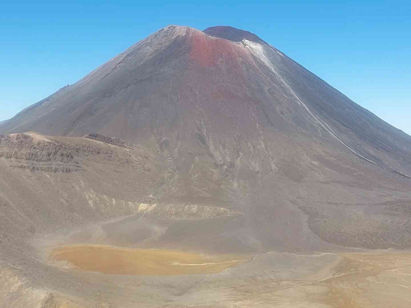
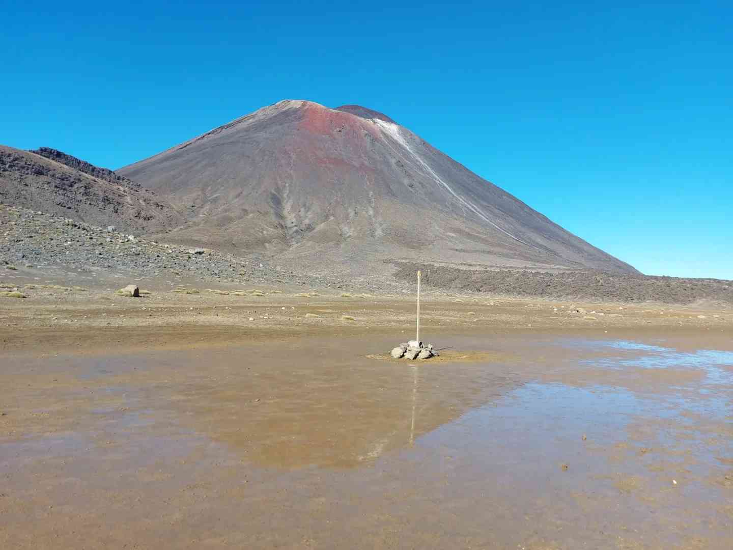
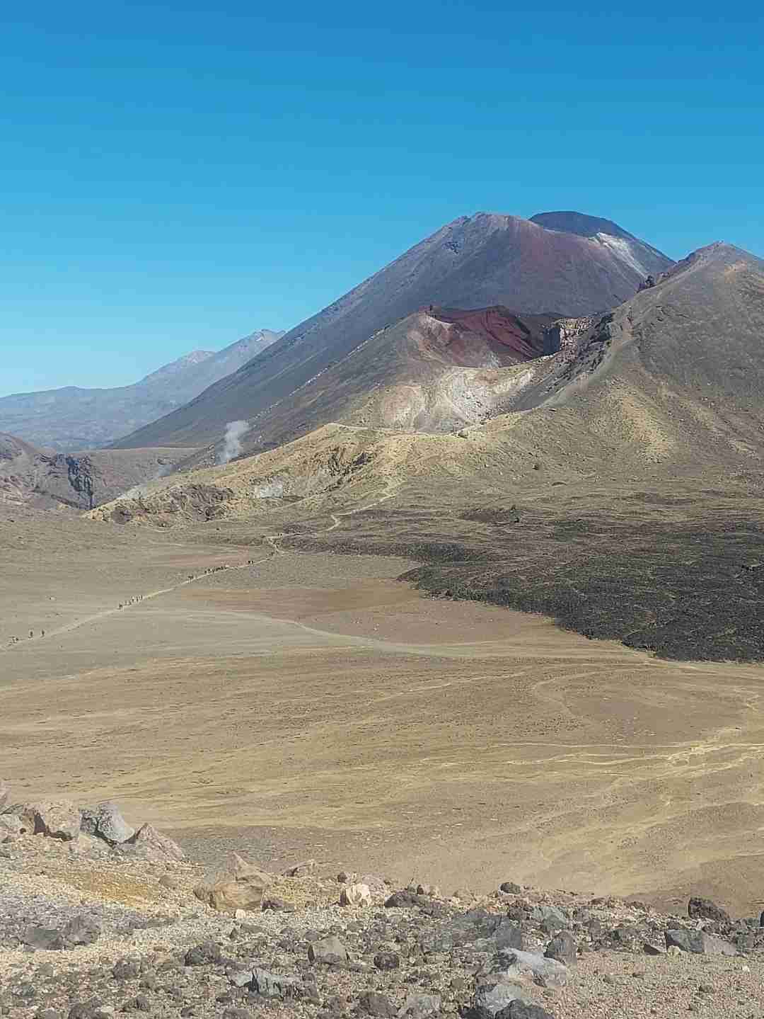
The first part of the hike circles around the base of Mt Ngauruhoe.
Mt Ngauruhoe is the volcano that Lord of the Rings fans instantly recognize as Mount Doom.
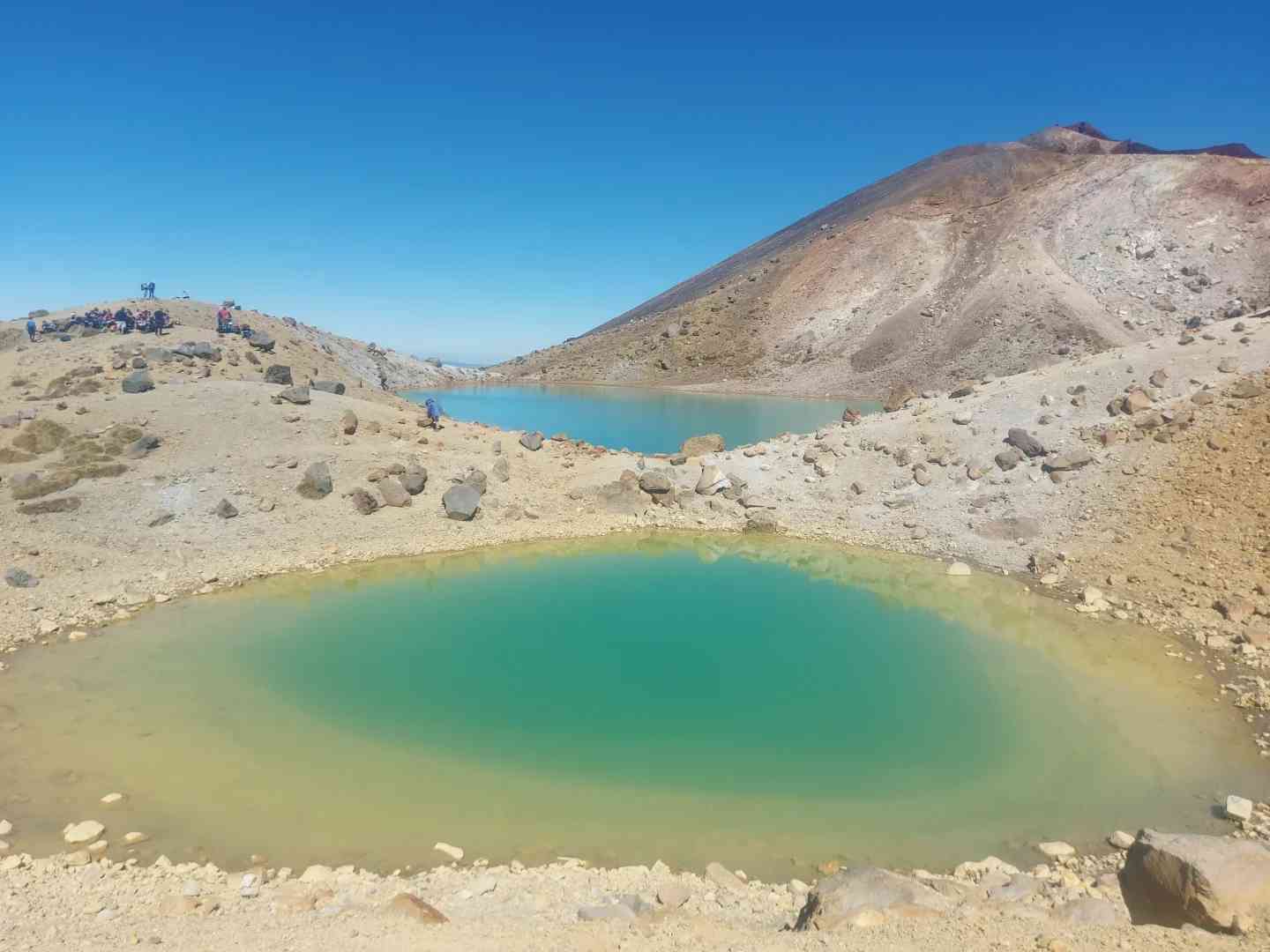
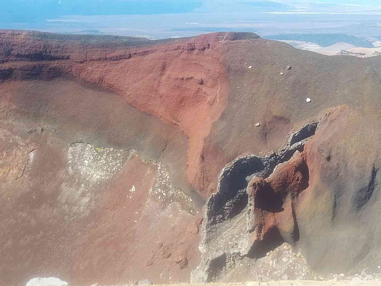
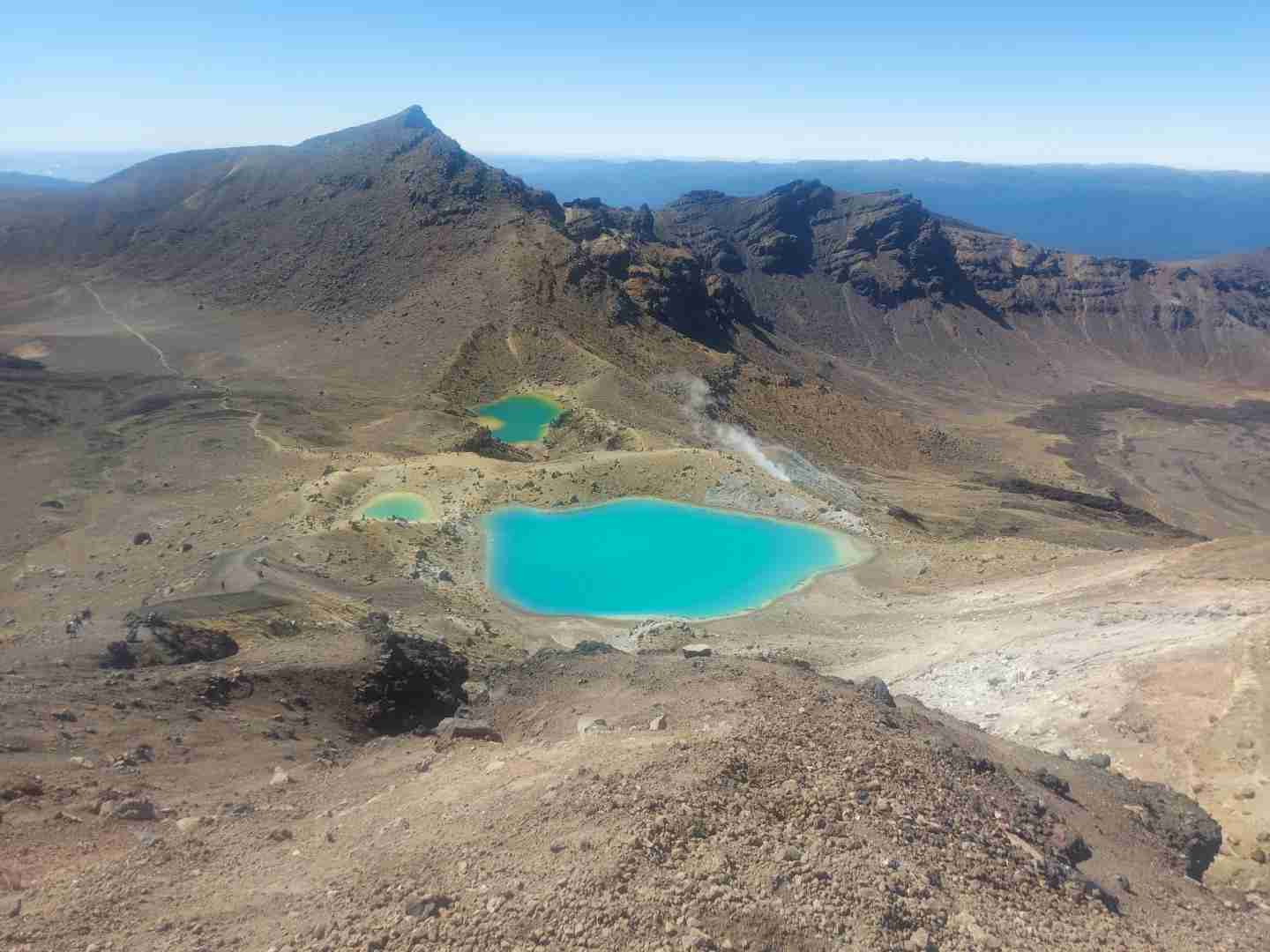
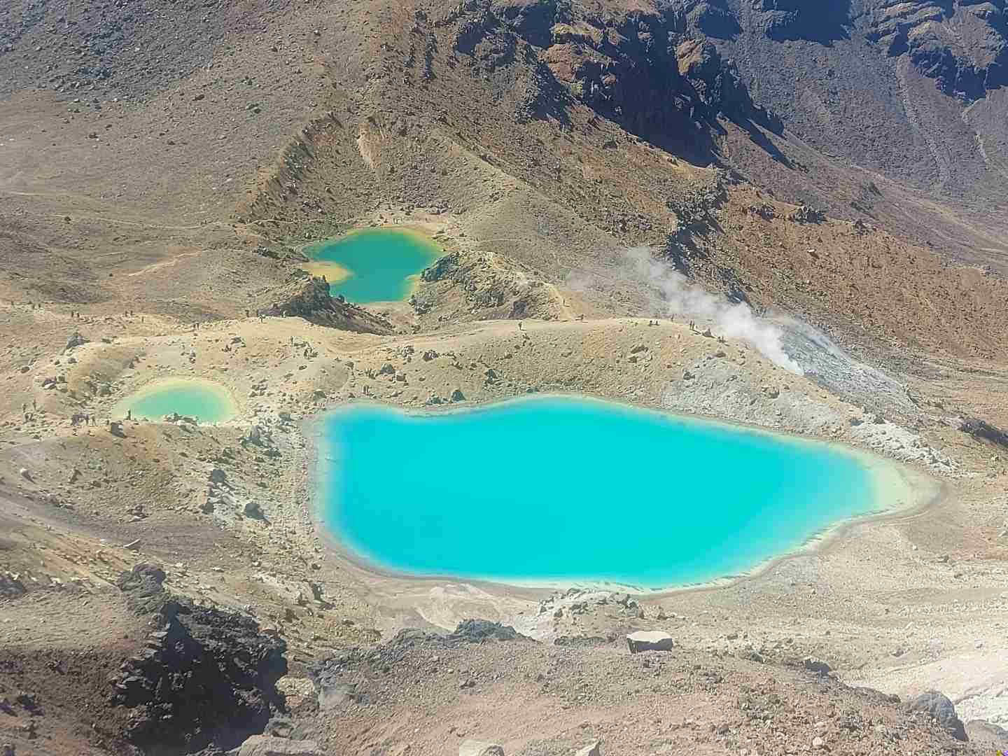
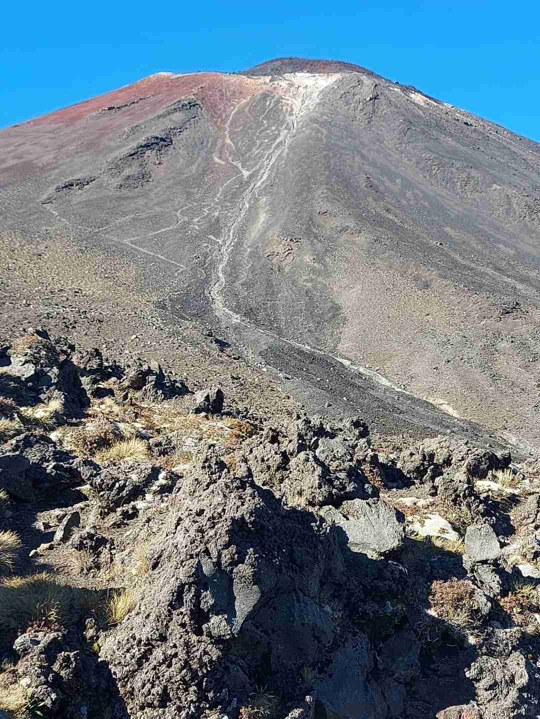
There are three climbs in total. After climbing the second peak, you can see the red crater and the three emerald lakes and one blue lake below. However, the descent is a 45-degree slope about 1 kilometer long (see images [一][二]), with loose gravel and sand.
Many people who can’t walk down end up sliding down while sitting.
The emerald lakes are beautiful, and you can walk along each of them. After the blue lake, it’s all downhill, with nothing much to see, making it quite dull.
You can also see Mount Taranaki in the distance.
If I had known earlier that the latter part was like this and wasn’t chasing the fame of completing the crossing, I would have turned back at the blue lake [sigh][sigh][tongue out].
Besides the Alpine Crossing, there is another slightly easier trail, Tama Lake. It is the same length as the crossing, 20 kilometers, but with only 600 meters of elevation gain.
The starting point is in the small village of Whakapapa. There are fewer than 10 parking spots for the trail, which are hard to get.
There are parking spaces on both sides of the road 100 meters before the visitor center, marked for 8:00 AM to 5:00 PM, but I left at 7:00 AM and didn’t get a ticket.
The trail has three highlights:
[一] Mt Ngāuruhoe on the left and Mt Ruapehu on the right
[二] Taranaki Falls. You can just do a loop to the falls, which is 6 kilometers.
[三] The lower and upper lakes.
The trail connecting the two lakes is a gentle slope of loose gravel and sand, offering a more relaxed and manageable trek compared to the steep and challenging Alpine Crossing.

